Tag Archives: Sights

Day 68: There are Places I Remember….

imageimageimagecropped-image38.jpg
image
imageimageimageimageimagecropped-image242.jpg

If I had had audio capability to enhance my blog, I would have inserted the Beatles song “In My Life” as the leader to this post. Its melancholy tone would have been apropos to my sentiment at the moment.

With this last official post to my blog, I wanted to share my thoughts on how fun, challenging, and rewarding it has been during my travels for 68 days around the world with myself and others. It has raced past and seldom felt lonely, particularly with the focus on sharing at least one event each day.

Having the blog felt the same as when you flick the TV on at home after a long day at the office. It’s comforting to hear the background noise as if others are in the room with you. Only at rare moments did I feel that I was communicating with outer space (anybody there? Any body??)

In any event, we are at the end of my adventure. It has been nothing less than a thrill. I’ve met some terrific people–Vladimir, Karen, and Meilina from my German class; the driver and guides in Uzbekistan; Morten in Emei Shan; and old friends Peter, Cordelia, and George from Hong Kong.

I tried my best to keep the pace on this travel magazine moving, not too heavy or intellectual, and fill the posts with timely information as I became more experienced in formatting more visuals.

My apologies again for any technical difficulties born in part by Google’s agreement with China and other conditions beyond my control. And pardon the caps being cumbersome and captions not aligning with pictures. I will have a word with the graphics department about its performance.

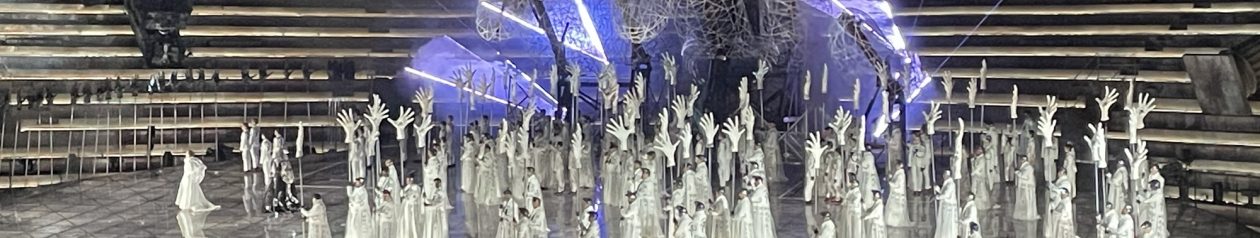
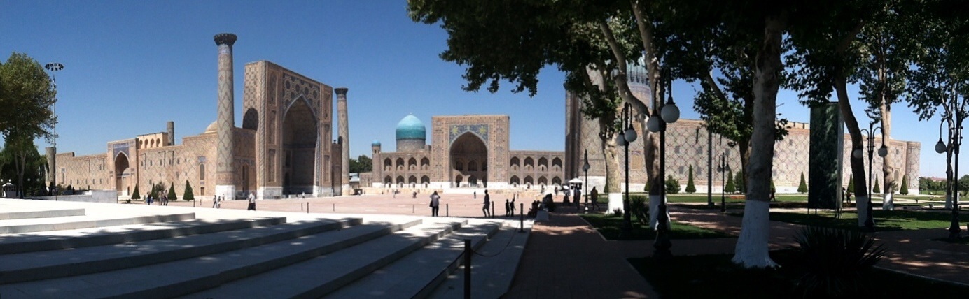
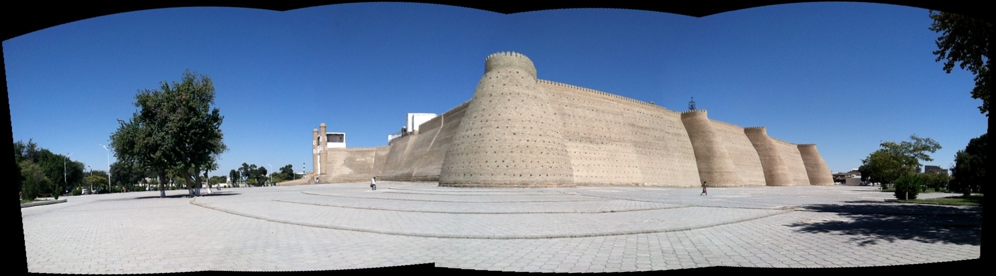
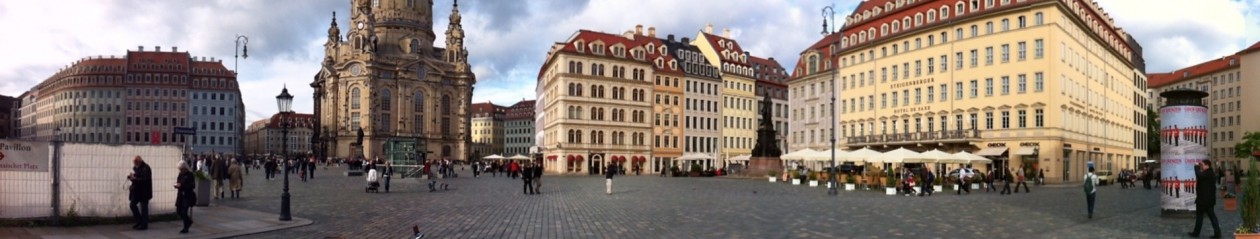
Since I am traveling back to San Francisco today, I’m recapping my trip through the panorama shots (not in any particular order) in case you missed them in the headers.

Photos, top to bottom:
1. Dresden Altstadt
2. Samarkand, Uzbekistan
3. Konigstein, Germany
4. Chengdu, China
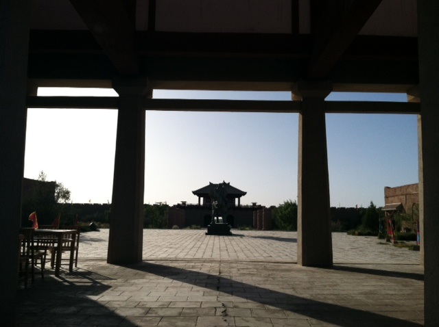
5.Gaocheng, Turpan, China
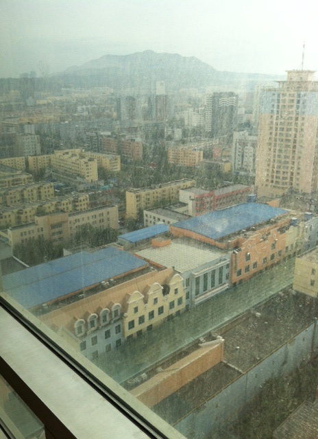
6.Urumqi, China
7. Hong Kong MTR
8.Guangzhou Civic Center
9. Chengdu Railway Station
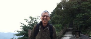
10. Top of Emei Shan, Szechuan

Call or email me if we have been out of touch during this time. I have lots of time and would love to hear from you.

Auf Wiedersehen, Zai Jian, and can’t wait to see Gee Kin, Melissa, and Julianne! Time to get back to the Real World!

With love,

Vickie Victoria

Day 64: HK MTR and Vertical Cities Symposium

Hong Kong was one of my old stomping grounds, so I was particularly excited about seeing old friends. After graduating from architecture school, I arrived here with $100 left in my pocket and a determination to work here for a year. I ended up staying for seven. Gee Kin and I met in HK, and, well, the rest is history.

I’ll tell you more about the my day traveling on HK’s mass transit system and today’s seminar on Vertical Cities that I attended through the annotated photos:

1. This was the interior of the car in the MTR system. After nearly 40 years since I first worked on it while it was under construction in 1976-78, the system has held up well. I remember trying to introduce some of the BART system concepts to the British who controlled development of the system at the time. They were not interested in the BART fledgling system, which was barely 10 years old at the time. Being true colonials, the engineers preferred to utilize the London tube or British Railway system as their precedents.

Nevertheless, it’s an efficient, well-maintained system. It hardly showed any wear and tear despite its mature age. I was told that there are some delays and breakdowns that are only just beginning to appear, but the system has run well until recently. This photo is a general overview of the train interior.

2. Cell phone mania is not particular to China. 5 out of 8 were actively using their cell phones in this cluster of people. If I had taken photos in other cities I visited, they would have been similar, and maybe only nominally lower in numbers.

3. A shop, inside the MTR selling pastries. The two unusual items that caught my eye were green tea and fig rolls (that I tried) and squid ink, tomato, olive and pickle pizza (that I did not try)

4. A upshot of high rises near Garden Road.

5. Speakers at the Asian Vertical Cities Symposium sponsored by the HK American Institute of Architects at the Asia Society

6. Asia Society Walkway design by Tod Williams and Billie Tsien to protect the local bat colony near HK gardens.

7. Flower arrangement in the Asia Society Building

The symposium consisted of an afternoon of presentations by local luminaries, followed by dinner and conversation. My good friend Peter Basmajian, a local HK architect who has lived in HK over 30 years, invited me to join him at this event. I also reconnected with George Kunihiro, a fellow architectural classmate from UC Berkeley. We had not seen each other for nearly 40 years! He happened to be visiting Hong Kong from Japan, where he now works.

A few salient comments from the symposium focusing on transit-oriented, high-density vertical cities included the following:

Ken Yang from Malaysia introduced his idea of green buildings and creating continuous linear parks as developed in the Solaris Building in Singapore for an ecological solution

In designing a building as part of a competition, you have to start with something interesting for a competition and end up with something different or unexpected, as shown in the winning design for the Crown Plaza project in Sydney, Australia.

Dinner topics included table discussions on sustainability, livability, affordability, and mobility. Many of the cities discussed include those in China, India, Indonesia, Thailand and Malaysia.

Day 60: the Great Railway Bizarre

image image image image

I’ve been traveling with Gee Kin by train for over a week throughout China and haven’t made much mention of the trains themselves except for the nice photos of the attendants on the night train from Turpan to Shulehe. Needless to say, it has been an experience. Since I was able to collect my thoughts on this next to final leg from Chengdu to Guangzhou, a 28-hour ride on my own, here are a few of them to share with you:

1. The Chinese trains have a few sweet touches, like flowers in the compartment, a thermos for hot water (for the instant noodles that everyone brings), table cloths, and drapes that the assistants come in and close for you at night. They also have a waste basket and a stainless steel tray for all the peanut shells and melon seeds that everyone eats on the trains to pass the time.

2. The toilets, well, are there. Modern ones with a commode. Use at your own risk. There’s a shared counter with three sinks. They close the facilities when the trains are inside stations, so you have to plan your strategy. These haven’t changed much since we did our Beijing-HK train ride for 36 hours back in 2000 with the girls.

3. You can buy tickets off the Internet through travelchinaguide.com.
They all worked, and communication was clear. A few blips, but overall very efficient. I am attaching some photos of the K and T trains we took.
The last one was a four compartment soft berth overnighter (K), and the one Gee Kin and I took to Shulehe was a 6 compartment hard berth version (T).

4. The food service is still decent. Chinese will always manage to feed you, with recognizable elements. The dining room and the takeout food brought to your compartment were reasonable. My breakfast consisted of a hard boiled egg, chopped green beans with spices, pickled turnip, green veggie with minced meat, and congee with scrambled egg.

5. The itinerary I took from Chengdu to Guangzhou consisted of massive cities with high rises everywhere. If you were wondering where the cranes were, they are all in China. Each city is in a massive building boom. There must be more cranes in all of China than everywhere else in the world combined, or at least it feels that way. The point is that no city was recognizable by name, with the exception of Chongqing. And they were all sizeable. Where have I been??? I feel like Rip Van Winkle, who overslept…maybe 5 years?

6. Despite Chongqing whisking right past me, I did see the Chang Jiang (Yangtze River) and portions of Guizhou that were Guilinesque near Guangdong in the morning. There were still pristine rice paddies, but with high rises off in the horizon. A nuclear power plant slipped by, and many many high rises that boggle the mind. Cities the size of Hong Kong seemed to float past, one after another.

Photos, from top, left to right:

1. Breakfast in the dining car
2. aisle to sleeping compartments
3. Dining car
4. view of Guizhou Mountains
5. High rises in distance to paddies
6. List of stops–most are major cities (recognize any?)
7. Screen shots of train soft berth compartment for 4
8. Screen shot of train hard berth compartment for 6 (shown earlier)
9. Screen shot of train exterior

Day 57: Scaling Emei Shan

image

At 3,000m, Emei Shan in Szechuan Province is one of the four sacred Buddhist mountains of China. We made a point to come to this area when Julianne recommended it after her trip there. Photos show some of the environment and the landscapes that “look just like a Chinese painting”…except that they are real.

Gee Kin and I climbed two of the major mountains in China in the past–Mt. Huangshan in 2000 and Tai Shan last year with Melissa, so this was our third.

Photos, from top, left to right:

1. Two wild monkeys chatting on the steps. They are prevalent in the hills around Emei Shan.

2. We stayed in accommodation halfway up the mountain in the middle of the photo. Don’t ask how we got there.

3. Xinxiang Temple

4. Along river gorge

5. Background for “a Chinese Painting”

6. Gee Kin with typical steps in the background


Day 53(b): Back on the Trail of the Silk Road

imageimageimage

We have been traveling in Turpan and Dun Huang for the past few days, tracking the portion of the Silk Road through Northern China. From Dunhuang, there were two routes westward. the northern route was faster but more dangerous, and the southern route was longer but easier. The easier route connected a series of oases that were 4 to 5 days apart, whereas the harder route stretched the distances between water. Traders and emissaries had to plan their strategies for survival carefully.

Aside from extreme weather conditions and access to food and water, they could not predict who they would encounter. Dunhuang was the outpost and garrison for the Han Dynasty troops. They regulated the comings and goings of each caravan and made sure that they were entitled to passage through these points. While the influence of the Sogdians from Samarkand and the current day Uighur population were prominent in Xinjiang, there appears to be reduced or little significance in the Gansu region.

The photos above are a replica of what existed on the site previously. It is difficult to reconcile original ruins that leave a lot to the imagination, with wanting to see something that is close to the conditions at the time the site was active. This site is now a museum and contains a lot of history that helps to bring the original situation to life.

If you think this looks more like a stage set, the irony is that there is a full scale working model of an ancient city in Dunhuang. It’s something like a Universal City. Crouching Tiger Hidden Dragon and other history-based films were shot there. We decided to pass on the experience.

Just a note on postings: still having problems uploading pictures and this continues to persist. Please let me know if you are still experiencing problems viewing them.

Day 49: Room with a View

image

To the left is a lovely view from our 25th floor hotel. Apologies for the dirty window.

Update: what a difference a day makes! The new panoramic photo shows today’s view. Urumqi is one of the 10 most polluted cities in the world, as cited by Tsinghua University. We had a strange deja vu when we arrived in Beijing a few years ago the day before National Day on Oct. 1. The same dramatic transition occurred miraculously, as if God opened up the skies!

Beijing and Taiyuan beat Urumqi for the record. Three million people here are the same number in population as Tashkent. Interesting to compare the two. Note the mountains in the background.

Status Report on photo uploads: between 4 devices (a computer, I pad, and 2 cell phones), we have not managed to figure out why the photos are not loading properly as they have in the past. I am going to abandon ship on the Day 48 posting.
The technical problems getting access to the internet continue to persist. It’s a connection between the host editor, wordpress, and the website that is not allowing the pictures to link. Thanks for your patience.

image

Day 46: Following the Yellow Silk Road…the Wizard of Uz


So Where’s Uzbekistan? First of all, it shares a commonality with Lichtenstein. It’s doubly landlocked with no access to a seaworthy port (the Aral Sea doesn’t count, but more about that later). As mentioned in earlier posts, water was everything in the distant past as it is today.

The Soviets wanted Uz. to produce cotton so they did. They relied on a single crop to supply the former Soviet Union, so after Peristroika, Uz was in trouble, with no diversification. The government seemed to switched to mixed crops as quickly as it could, but it took a lot of water to grow cotton. That sapped the supply of water from the border river they share with Kyrgyzstan, so now they have to buy water for neighboring Tajikistan.

Traveling along the Great Silk Road today (7 hours by car from Bokhara to Kiva, another UNESCO world heritage site), I actually saw camels on the highway! That blew me away, until I saw an accident a few minutes later. There was a dead man in the crossing. His car was tipped over sideways and it looked like he was hauling some gas tanks. He looked scorched.

Otherwise, this could be a typical 90 degree summer day. Here’s the report ala Ruth Reichl Twitter style:

Cloudless sky. No smog. Gentle people. Girls walking home to lunch from school. Boys riding bikes. Huge birds with long tails. Stray oxen, cattle, donkeys, and goats. Dead flat. Power lines on horizon.

The driver has been very careful. After driving two hours with the windows closed, he rolls down window exactly one minute after I wonder why he hasn’t done so. He figured there’s no need to use the AC. (just because they say the car has AC doesn’t mean that it will be used, does it!?) But it suits me fine. There were uneven road surfaces everywhere. It took 8 hours to drive 500 km or 300 miles for what would take only 5 hours on I-5, but we’re not in California, right? On the last drive, he didn’t use the AC until the last half hour of a 4.5 hr ride. Made sense.

Driving along the Silk Road for eight hours can wax you poetic. There were prominent mounds every so often, that served as watering holes. The caravansaries were pitched nearby and served as stopover points along the Silk Road. Being dead flat seemed to make it a no-brainer for travel to progress along the way, in the way that it did. There were markers with strange clipped brushes pushed upside down to mark the way. (See photo above, markers are in mid-ground). We followed that path for half the time, then it disappeared. I pictured Gee Kin and me trekking along the path. Flat, marked path is a piece of cake so no desperate need for Google maps? Oops, no shade.

So back to Uz. There are about 30 million people here, mostly in agricultural communities. (Tashkent holds about 1/10 of the population or 3 million people, but most cities are small). It is run by Karimov, a “benevolent dictator” who has been in power for the last 23 years. Uz. Also has natural gas, uranium and is developing electricity.

Because cotton was grown here and the land absorbed so much water, the river also began to run dry and the Aral Sea that used to collect the water dried up. What used to be a port city is now sitting in the middle of a peninsula! San Francisco or Oakland suddenly becoming Stockton! It didn’t take very long so it’s definitely a word to the wise. Now they are trying to deal with all the salt in land where it used to be a lake. Less than 50% of the water is left; it used to be the fourth largest body of inland water in the world. (See photo above).

Just a few stray thoughts after yesterday’s post: I was told that Armenians were the best craftsmen and were recruited to come work on some of the buildings in Bokhara. Iranians were considered the best architects. It’s no wonder, with their attention to gardens and outdoor spaces, math and geometric skills, and beautiful interpretations of color and lighting.

As for insights on pilgrims visiting these sights: I noticed that a few visitors walked around site three times before entering the mosque or mausoleum. It was considered bad luck if you didn’t. They also rubbed sacred trees so some of the good luck would rub off, and they also practiced leaving money on the crypts. It was a way to wish for good things and have them come true.

In case you ever wondered where the fat French women were…they’re all in Uz. I can’t compare them to any Americans because there aren’t any here.

Day 45 (a): Bokhara II

As a UNESCO World Heritage site, Bokhara has an extensive collection of Islamic Architcture.

Photos above, from top, left to right:

1. Map of the Great Silk Road: this week I am traveling along it from Tashkent to Khiva (Uzbekistan) and next week from Turpan in Northwestern China to Dunhuang.
2. the Ark (it wasn’t just Noah’s): the ceremonial grounds to the Fortress required visiting dig arises to back out after having an audience with the Amir. When the guest reached the wall in front of the exit, he knew he could turn around and leave.
3 and 4: the Ark from the exterior: big voluptuous corner and side wall fortifications
5 and 6: Samonid Mausoleum, one of the earliest remaining buildings in Bokhara, built between 9th and 10th C. Purported to be a masterpiece of world architecture and a perfect geometric form built of brick. Beautiful texture, but looked a little bit like an Irish fisherman sweater.
7. Interior Corner of Samonid Mausoleum: corner elements cleverly reconcile weight of circular dome over walls by being slightly smaller in diameter than width of square.
8. Samonid Mausoleum Tomb: both father, son, and grandson are buried in the tomb. he father’s tomb was originally in the middle, and the grandson was the third tomb, but they were they were all moved into one tomb and thus the offset position.
9. Kalyan Mosque is the largest mosque in Bokhara and second largest in Uzbekistan. The old wood columns are typical of the period and were periodically replaced.
10. Kalyan Mosque: Praying is conducted outside due to the mosque’s popularity. On Fridays, the mosque can hold up to 12,000 people. A electronic board indicates the times of prayer.
11,12, and 13: Courtyard and surrounding galleries of the Kalyan Mosque. (Header also shows overview of Courtyard, where worshippers pray)
14. Medressee Miri-Arab Madrasah: Opposite the Kalyan Mosque, this highly regarded spiritual Islamic University was built in the 16th C.