Tag Archives: Sights

Day 46: Following the Yellow Silk Road…the Wizard of Uz


So Where’s Uzbekistan? First of all, it shares a commonality with Lichtenstein. It’s doubly landlocked with no access to a seaworthy port (the Aral Sea doesn’t count, but more about that later). As mentioned in earlier posts, water was everything in the distant past as it is today.

The Soviets wanted Uz. to produce cotton so they did. They relied on a single crop to supply the former Soviet Union, so after Peristroika, Uz was in trouble, with no diversification. The government seemed to switched to mixed crops as quickly as it could, but it took a lot of water to grow cotton. That sapped the supply of water from the border river they share with Kyrgyzstan, so now they have to buy water for neighboring Tajikistan.

Traveling along the Great Silk Road today (7 hours by car from Bokhara to Kiva, another UNESCO world heritage site), I actually saw camels on the highway! That blew me away, until I saw an accident a few minutes later. There was a dead man in the crossing. His car was tipped over sideways and it looked like he was hauling some gas tanks. He looked scorched.

Otherwise, this could be a typical 90 degree summer day. Here’s the report ala Ruth Reichl Twitter style:

Cloudless sky. No smog. Gentle people. Girls walking home to lunch from school. Boys riding bikes. Huge birds with long tails. Stray oxen, cattle, donkeys, and goats. Dead flat. Power lines on horizon.

The driver has been very careful. After driving two hours with the windows closed, he rolls down window exactly one minute after I wonder why he hasn’t done so. He figured there’s no need to use the AC. (just because they say the car has AC doesn’t mean that it will be used, does it!?) But it suits me fine. There were uneven road surfaces everywhere. It took 8 hours to drive 500 km or 300 miles for what would take only 5 hours on I-5, but we’re not in California, right? On the last drive, he didn’t use the AC until the last half hour of a 4.5 hr ride. Made sense.

Driving along the Silk Road for eight hours can wax you poetic. There were prominent mounds every so often, that served as watering holes. The caravansaries were pitched nearby and served as stopover points along the Silk Road. Being dead flat seemed to make it a no-brainer for travel to progress along the way, in the way that it did. There were markers with strange clipped brushes pushed upside down to mark the way. (See photo above, markers are in mid-ground). We followed that path for half the time, then it disappeared. I pictured Gee Kin and me trekking along the path. Flat, marked path is a piece of cake so no desperate need for Google maps? Oops, no shade.

So back to Uz. There are about 30 million people here, mostly in agricultural communities. (Tashkent holds about 1/10 of the population or 3 million people, but most cities are small). It is run by Karimov, a “benevolent dictator” who has been in power for the last 23 years. Uz. Also has natural gas, uranium and is developing electricity.

Because cotton was grown here and the land absorbed so much water, the river also began to run dry and the Aral Sea that used to collect the water dried up. What used to be a port city is now sitting in the middle of a peninsula! San Francisco or Oakland suddenly becoming Stockton! It didn’t take very long so it’s definitely a word to the wise. Now they are trying to deal with all the salt in land where it used to be a lake. Less than 50% of the water is left; it used to be the fourth largest body of inland water in the world. (See photo above).

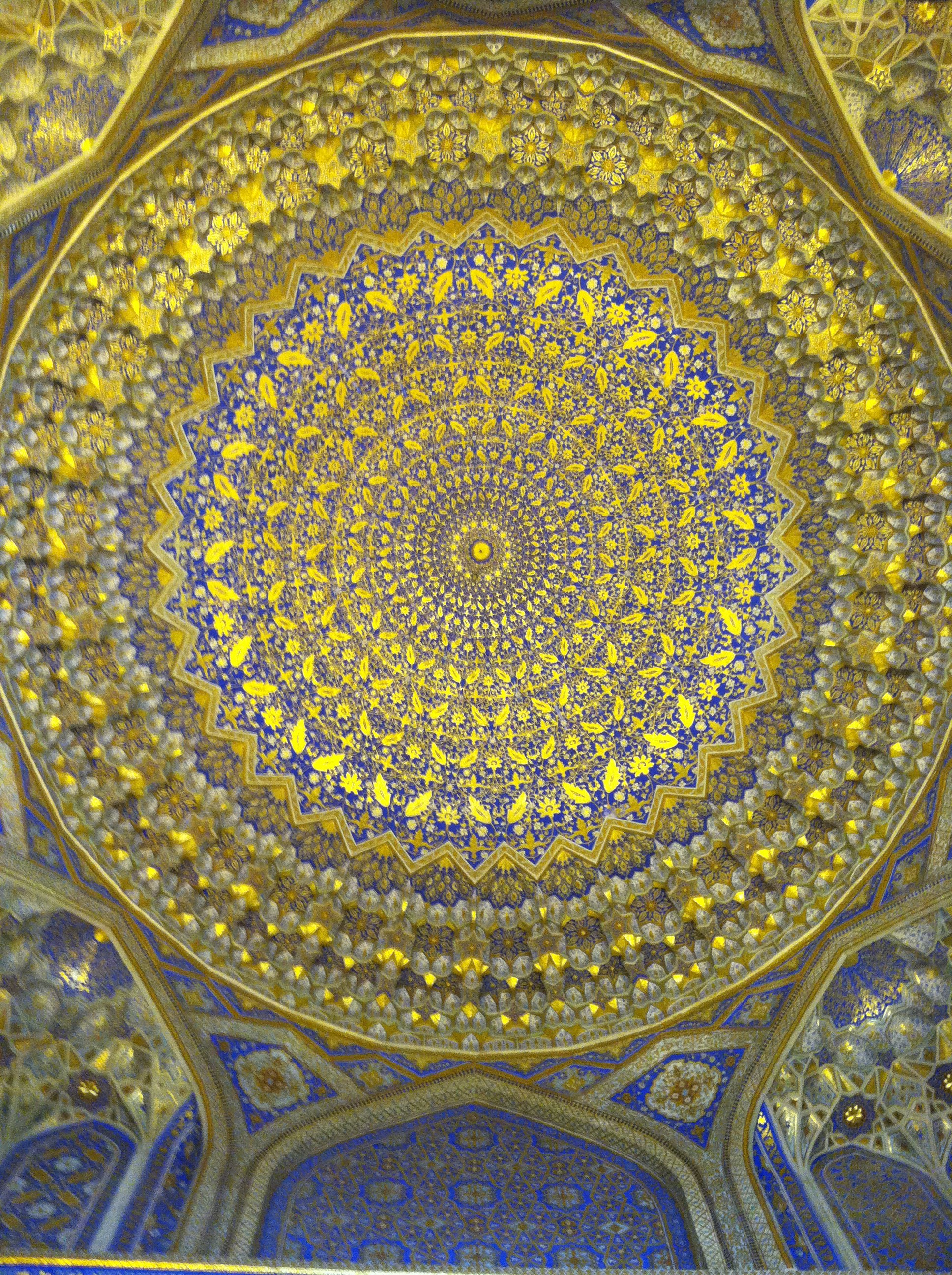
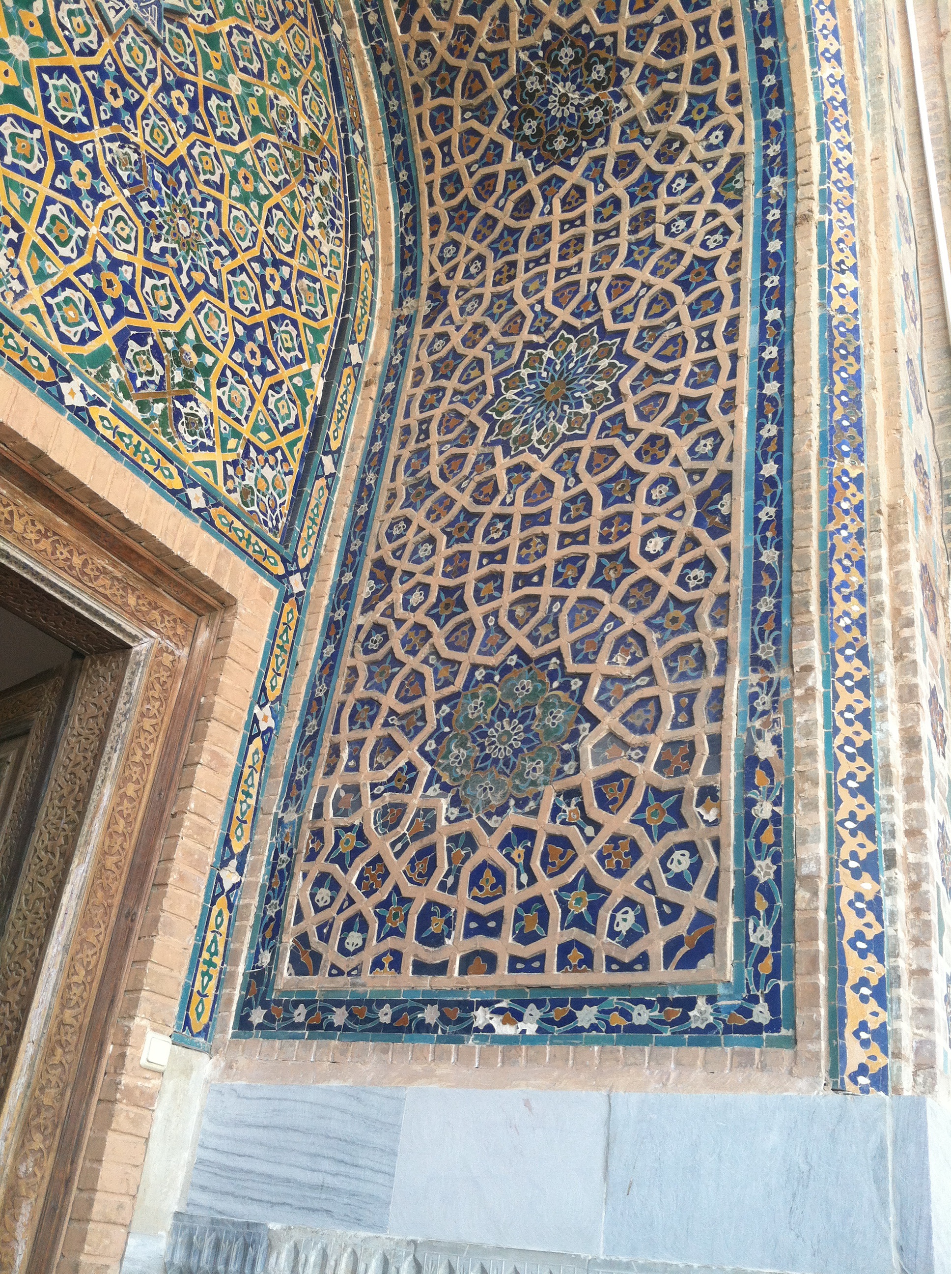
Just a few stray thoughts after yesterday’s post: I was told that Armenians were the best craftsmen and were recruited to come work on some of the buildings in Bokhara. Iranians were considered the best architects. It’s no wonder, with their attention to gardens and outdoor spaces, math and geometric skills, and beautiful interpretations of color and lighting.

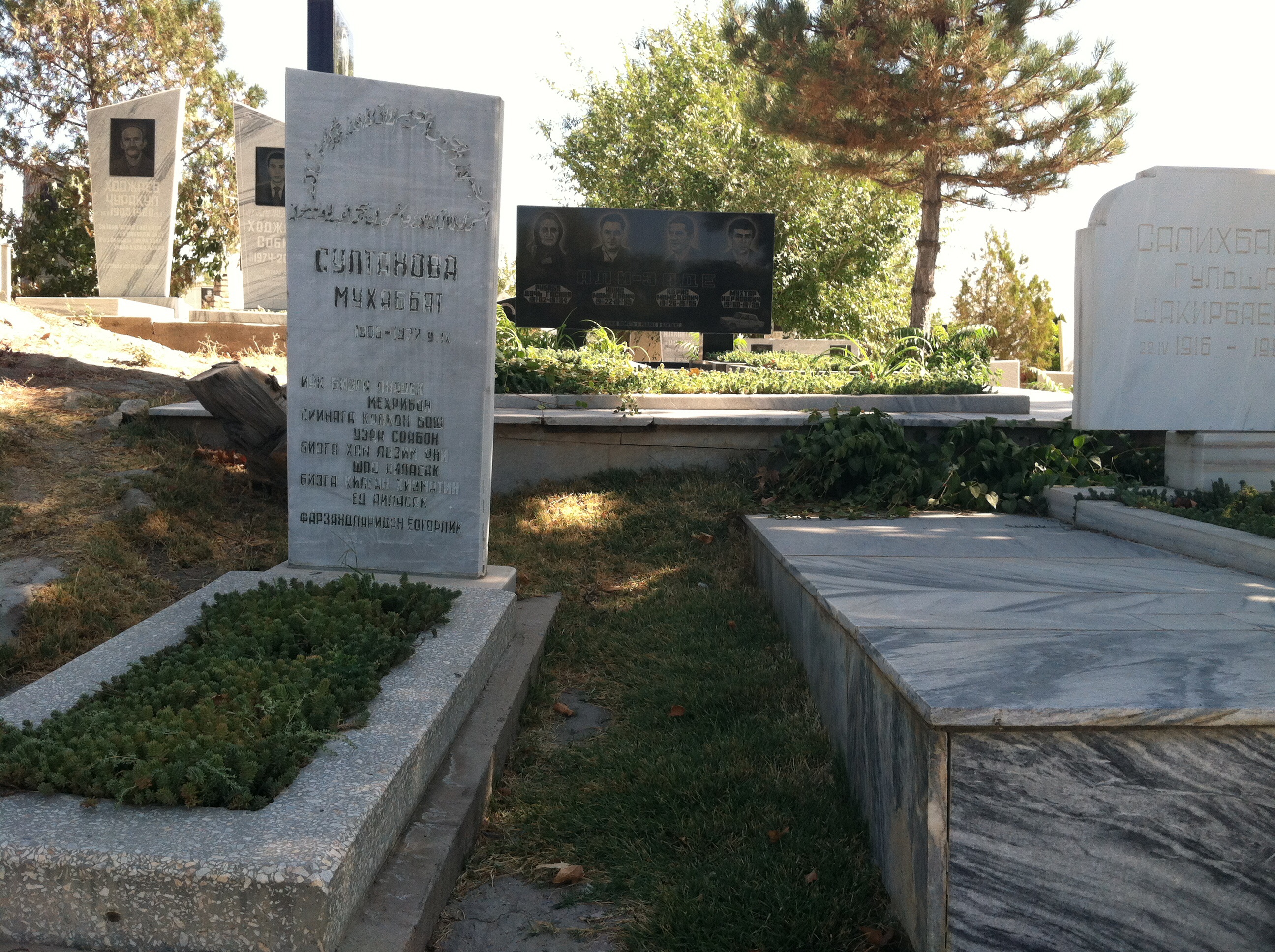
As for insights on pilgrims visiting these sights: I noticed that a few visitors walked around site three times before entering the mosque or mausoleum. It was considered bad luck if you didn’t. They also rubbed sacred trees so some of the good luck would rub off, and they also practiced leaving money on the crypts. It was a way to wish for good things and have them come true.

In case you ever wondered where the fat French women were…they’re all in Uz. I can’t compare them to any Americans because there aren’t any here.

Day 45 (a): Bokhara II

As a UNESCO World Heritage site, Bokhara has an extensive collection of Islamic Architcture.

Photos above, from top, left to right:

1. Map of the Great Silk Road: this week I am traveling along it from Tashkent to Khiva (Uzbekistan) and next week from Turpan in Northwestern China to Dunhuang.
2. the Ark (it wasn’t just Noah’s): the ceremonial grounds to the Fortress required visiting dig arises to back out after having an audience with the Amir. When the guest reached the wall in front of the exit, he knew he could turn around and leave.
3 and 4: the Ark from the exterior: big voluptuous corner and side wall fortifications
5 and 6: Samonid Mausoleum, one of the earliest remaining buildings in Bokhara, built between 9th and 10th C. Purported to be a masterpiece of world architecture and a perfect geometric form built of brick. Beautiful texture, but looked a little bit like an Irish fisherman sweater.
7. Interior Corner of Samonid Mausoleum: corner elements cleverly reconcile weight of circular dome over walls by being slightly smaller in diameter than width of square.
8. Samonid Mausoleum Tomb: both father, son, and grandson are buried in the tomb. he father’s tomb was originally in the middle, and the grandson was the third tomb, but they were they were all moved into one tomb and thus the offset position.
9. Kalyan Mosque is the largest mosque in Bokhara and second largest in Uzbekistan. The old wood columns are typical of the period and were periodically replaced.
10. Kalyan Mosque: Praying is conducted outside due to the mosque’s popularity. On Fridays, the mosque can hold up to 12,000 people. A electronic board indicates the times of prayer.
11,12, and 13: Courtyard and surrounding galleries of the Kalyan Mosque. (Header also shows overview of Courtyard, where worshippers pray)
14. Medressee Miri-Arab Madrasah: Opposite the Kalyan Mosque, this highly regarded spiritual Islamic University was built in the 16th C.

Day 44: Bokhara I


Fast facts: The population of Bokhara today is 280,000. Bokhara is the oldest city and predates the others at 2750 years old. Just for comparison, Samarkand’s population is 500,000 and Tashkent’s is 3 million.
The land is flat, considered steppe and not desert (a desert designation is devoid of vegetation, and steppe has some visible vegetation if sparse–you know, kinda like the Bay Area).

Photos, from top, left to right:

1.  Nodir Devon Begi Madrassah 1623. This is one of the later buildings dedicated not to the king but a lower ranking official. By the time the buildings were dedicated to others the central govt was already in decline. The phoenix birds show Indian or Chinese influence. The face at the top was not banned at the time in artwork and different interpretations are made as to whether images are acceptable or not. The use of multicolored tile and yellow is also a late development, compared with the earlier cobalt and turquoise monochromatic schemes.
2. trading market designed and as covered market at crossroads to two streets. There were 5 built-in the city but they didn’t work so well. The earlier strip markets developed organically around neighborhoods. These did not take into account where people lived and needed the services. These trading markets are now mainly tourist attractions after they were designated for specialized trades such as metalwork or arts and crafts. Open cross ventilation makes this a very cool and sustainable place in the summer though!
3.wood door detail inside trading center
4. the water system was crucial to survival of the cities. Bokhara was considered an oasis along the trade routes and served as the seat of many governments who conquered and ruled this strategic location. Water came from the river that separates Afghanistan and Uzbekistan, but is now piped from the mountains in Tajikestan.
5. the minaret, made of bricks, shows how creative their brick craftsmen were in designing and pushing the height of these lighthouses.
6. contemporary building using wood columns and doors decoratively.
7. The earliest building in Bokhara was built below grade and preceded the Mongol invasion around the 12th c. Most buildings, particularly Islamic structures were built on top of the sites of former sacred sites, so it is likely that an earlier building preceded this one. This building is devoid of tile decoration but shows how use of brick for both structural purposes and textured walls was used very successfully, prior to the introduction of tile.
8.Detail of brick work.

Day 43(b): Back Street Boys

imageimage

On the back of the low hill where the Mausoleums were clustered, was a contemporary cemetery. It proved to be a fascinating portrayal of how a society sees itself. The families of the recently departed wanted to make sure everyone knew how prominent their deceased relative was. Photographs are etched into tombstones: images of husband and wife, generals, academicians, politicians, and even a family of four caught in a car accident, all with the same date of death, left you with an empty feeling that you might have known these once alive individuals.

Day 42 (a): Samarqand

imageimage

image

image

The first day of this segment has overwhelmed me with history, jogging my brain and challenging all of those connections between Alexander the Great, the Mongols, and Tamir. Some of you may know this better, but for me, it’s learning on the job.

Lets start with Tamir and work back. Many of the madrasah photos shown here date from around the beginning of the 15th century. A madrasah was the focus of education, and included a library, classrooms and a place of worship. Tamir was from Samarqand and made a campaign to conquer India. His grandson was the scientist and developed an observatory and promoted a lot of concepts developed by the Arabs and and the Chinese.

2. When the Mongols struck in the 13th Century, they basically burned every town and village they encountered to the ground. Many of the relics predates this period, but the buildings are no longer standing. Alexander the Great conquered this area, but there is still some debate where and how long he ruled. He was physically here in the area with his army.

3. The complex of 3 madrassahs were built in two different periods: the one on the left was first developed in the early 1400s and the latter two that form a courtyard were from the 1500s. The later buildings were designed to form a symmetrical triad of buildings, but the domes are not symmetrically placed. There is a balance between symmetry and asymmetrical elements.

4. There were multiple religions operating at the same time, including Christian, Hindu, Muslim and Judaism. Sayings in Arabic on the entries to the building welcome all religions but only believers. These were sacred places of education held in high regard, and the eight major faculties each had their own rooms. Women were encouraged to learn in these institutions.

Extensive reconstruction of the tile work and buildings were made in the last few years. A bazaar used to be in the courtyard but the vendors have been relocated to preserve the structures.

Photos, from top:

1. Overview of Madrassah Complex, Samarqand

2. Map of Uzbekistan. My route is Tashkent-Samarqand-Bokhara-Khiva-Tashkent

3. Golden dome from inside, designed flat to reflect sound of prayer inside

4. Detail of stone tracery integrated with mosaic tiles to create textured pattern

Note: Internet access getting sporadic and unpredictable, particularly as I go further inland into the country. Keep your fingers crossed. I have an excellent guide but it is difficult to catch everything as she is covering a lot of ground. I’ll try to fill you in as I go.

Day 40: Farewell to Dresden

image

imageimage

imageAs I wind down this segment of my travels, I feel very sad to leave Dresden. Particularly having bonded with my German class, it is hard to say goodbye. Everyone has their lives to live beyond this momentary blip in the universe. I’m so grateful for having had the support and encouragement from family and friends to do this, at this time of my life, because it IS the time of my life.

I felt wistful about leaving out some shots that didn’t ever seem to fit into the theme for the day. This is a potpourri of architectural photos, a one-off sign, and some cultural relics. I’ll be leaving Dresden, overnighting in Frankfurt, then starting Segment 3 of the Silk Road this weekend.

Photos above, from top:

1. The Blood Center

2. Clinical buildings in the medical center area of Dresden.

3. Another clinical building.

4. Sign indicating from the Pirate Party that there is room for another million residents in Sachsen, the state where Dresden resides. It also implies that mixing and matching population is good for Saxony. (tap up the scale to read text).

Party elections are coming up and Angela Merkel is scheduled to come to Dresden on Saturday. Unfortunately, I will be off before then, but I would have definitively gone to see her.

Photos below, from top:

1. The Molkerei, a dairy and classic cheese shop that has been around for generations. The ornate decoration makes this a popular tourist stop.

2. The interior of the Frauenkirche, where Helena and I attended a concert. Maria Baumer played the part of Bach’s wife in several readings between Bach pieces. The concert was sponsored by the Moritzburg Festival.

3. Another panorama shot of Dresden and surrounding area from the Konigstein fortress. Zoom up to appreciate the beauty of this area.

imageimageimage

Day 35: Moritzburg Palace

image image image image image

The Moritzburg Palace was King Augustus’ playground for hunting. Only a mere 20 minutes’ drive from town, he could feel that it was a great getaway place but still reduce the carbon footprint. The most impressive part of the palace were the mooseheads, of every shape and variety you could imagine. They really looked like branches from some sacred trees, each individually chiseled and honed.

The other distinguishing mark to this palace unlike others throughout Europe were the leather tapestries. They had a lot of animals in the Wald so they made use of the skins by sewing them together and adding embossing for depth and texture, as well as paint from gold and other colors. The formal gardens were clean if not a bit sterile, but the strolls throughout the forest and surrounding area were extensive and well worth a day’s visit.

Moritzburg was in the midst of celebrating its Music Festival. They highlight young musicians hosted by the Dresden Musikfestspiele’s own director, Jan Vogel. The performers were the ones I heard in Proschwitz Palace. This Palace and the church are used as venues for performances, and would be well worth planning as part of a weekend stay.

Photos, from top:
1. Overview of Backyard.
2. Horsemen taking stroll along the extensive paths throughout Moritzburg.
3. An intriguing enclosed garden surrounded by a wall of manicured trees
4. A typical horse cart taking a shortcut through the palace grounds
5. Evening view of Moritzburg.

Day 29: Lovin’ Loschwitz

imageimageimage

Helena and I spent our afternoon taking a long walk from the Carnival scene at Altstadt and Neustadt areas to Loschwitz. We strolled at a leisurely pace along the Elbe and stopped twice for lunch and a water break at restaurants with outdoor dining. We were able to catch up on a few years’ work and play between us.

Along the way we passed a paddock not far from the riverside where horses are trained. It was amazing to see such a large yard along the river, not far from town. The lush green was reflective of large open spaces and extensive open spaces for the city’s residents.

We even managed to take in a cultural highlight of the Loschwitz area. The building in which the Leonardi museum is located was originally owned by a landscape painter. He wanted artists to be able to live and work together and dedicated the building to this cause. It was used for this purpose initially, but eventually the plan did not survive. The building has been turned into a museum for artists’ work.

If you are interested in reading more about this museum, please see http://www.leonhardi-museum.de/index.php?option=com_content&view=article&id=13&Itemid=12.

Photos, from top:

1. View of paddock near the Blue Wonder Bridge and Schillerstrasse.

2. Front facade of Leonardi Museum, with extensive German script used to decorate exterior of building. There are other examples of titles, sayings and poetry used on buildings in this neighborhood.

3. Detail of support.

Day 27: Dresden City Festival

image

imageimage

The  City Festival, between  Friday and Sunday  August 15-17, was launched in earnest, casting a whole new dimension to the city I had never before seen.  Most events occurred late at night around 11pm, drawing huge crowds of young people to rock events, carnival rides and cheap food. Plenty of security police were around to maintain civil order despite lots of beer consumption.

The theme this year is the Canaletto Festival. Dresden is known as the Florence of the Elbe. Canaletto was known to have painted a famous scene of the Elbe River, and the scenery is forever tied to the romantic view of Dresden.  Naming the festival after the Canaletto painting pays homage to the city’s cultural and artistic heritage.

In our class Friday we were asked to work in groups to describe three recommended events for the festival. We had to defend our position on why we thought our recommendations were the best. My group recommended a rock band, Tai Kwon Do exhibition, and a rubber ducky competition between two teams. Natürlich auf Deutsch.

My friend Helena arrived from Zürich for the weekend.

Day 20: Konigstein

imageimageimage
image

The Goethe Institute offered a weekend day excursion to one of the beautiful nature areas outside Dresden, near Bad Schandau, a resort, and near the Czech border. We hiked to the top of the fortress from the train station located at the river’s edge.

Water was pumped up to the fortress and it was a fully functioning camp during the early 18th century. Until recently, it was used as a prison.

Photos are taken from the top of the Konigstein Fortress:

1. Breathtaking views of the Elbe River below.
2. Butte on the other side of the river
3. View of the town below where the train station and start of climb is located.

For additional Reading, refer to:

http://en.m.wikipedia.org/wiki/Festung_Königstein